Wednesday, October 05, 2005

Guam

According to the Lonely Planet, Guam is the metropolis of Micronesia. At 210 square miles and 163,000 people, Guam is the most populous of the islands and is the vacation destination for planeloads of Japanese and other tourists eager to snap up the duty-free items from the innumerable strip and mega malls that dot Tumon Bay and Tamuning. Beyond these overcapitalized areas, Guam's northern and southern regions are patchwork of sleepy villages, small coves, and picturesque beaches.

Guam's indigenous people, the Chamoros, have inhabited the Marianas Archipelago since at least 1500 BC. Believed the have migrated from Indonesia, the Chamoro were the first culture in Micronesia to cultivate rice prior to Western Contact. Their culture was stratified and based on matriarchal clans in which most farming, construction and building of canoes was done by men while women prepared food, fished along the reef, and made various baskets and pottery items.

The first western contact occurred in 1521 with the landing of Ferdinand Magellan on the Trinidad in Umatac Bay. As they dropped anchor, Magellan's ships were greeted by a flotilla of canoes. Miguel Lopez de Legazpi arrived forty four years later, officially claiming Guam and the Marianas for Spain. For the next 250 years, Spanish galleons stopped in Guam to take on provisions during annual voyages between Manila and Acapulco. Interestingly, nearly 150 years passed between Magellan's landing and any real attempt at Western settlement.

The establishment of a small Catholic mission by Diego Luis de Sanvitores in 1668 marked the beginning of the missionary period. Initially receptive, it didn't take long for the Chamoros to realize their very culture was under attack. Ensuing rebellion and warfare lasted for nearly 20 years, by which point war, smallpox and influenza had decimated the population, leaving less than 5,000 of the original 100,000 Chamoros

It wasn't until 1822 that American whaling ships visited Guam. During the peak whaling years of the 1840s, hundreds of ships passed through Guam's waters. In April of 1898, the US declared war on Spain. Two months later, the American warship Captain Henry Glass arrived firing volleys into Apra Harbor. She was greeted warmly by the Spanish authorities who, having no idea their two nations were at war, apologized for not having enough ammunition to return the salute. The next day, Guam was surrendered to the Americans.

Japanese bombers from Siapan to the north attacked Guam on December 8, 1941 (the same day as the attack on Pearl Harbor taking the date line into account). Undefended, Guam fell two days later to the 5000 strong Japanese force. The Japanese immediately began teaching the remaining Chamoros Japanese. Initially the Chamoros were left alone but, as the war turned for the Japanese Guamanians were placed in work camps to build fortifications or were forced to farm to provide food for Japanese troops. On July 12, the remaining Guamanians were forced into concentration camps on the eastern side of the island.

The US assault on Guam began July 17, 1944. Four days later, 55,000 US troops landed on the beaches at Agat and Asan and the US had secured Guam by August 10th at a cost of 17,500 Japanese and 7,000 US lives. In the following weeks the population soared to over 200,000 as US servicemen poured into the island in preparation for an invasion of the Japanese mainland. Nearly one-third of Guam was confiscated by the military for bases which were heavily utilized during both the Korean and Vietnam wars.

While many of the traditional Chamoro ways have been replaced by strip and mega malls displaying the wares of Planet Hollywood, Tiffany's and the like, there are still areas of the island that retain the feel of the tropical Pacific. Our first night in Guam we were treated to a feast by the local fishermen's co-op. We were greeted with traditional baskets containing fruit and vegetables of every variety. For the 75 or so people in attendance, there were an additional two full tables of food, more than double our number could eat. Fresh fish of every variety, sashimi, sweet potatoes, bread fruit, a whole pig, and more deserts than I could count! After dinner and much talking, a troupe of native dancers treated us to a show that lasted nearly half an hour. Ranging in age from 3 to 12 they performed a number of native Chamoro dances in full regalia followed by fire dances with flaming batons and small clay pots on the ends of rope filled with flaming oil of some sort. Despite the rain, it was truly spectacular and very special.
Underwater Guam and a Special Find

Guam's underwater world has defied expectations. With the level of human habitation and building on the island, I expected the reefs to be less that spectacular to say the least. It appears, however, that I was presumptuous. While the windward (eastern) side of the island bears all the marks of heavy wave exposure, relatively barren turf algae covered pavement with large boulders, the leeward side of the island boasts wonderful reefs which, although devoid of large fishes, harbor a multitude of smaller fishes, corals, and invertebrates. Indeed, some of the reefs on the leeward side of Guam have had some of the highest levels of live coral cover of any on the trip. I have continued to see lionfish, clownfish in their anemone homes, butterflyfish of every variety, and the occasional Napoleon wrasse.

Yesterday's first dive yielded a particular find as I spied an Olympus digital camera in an underwater housing lying on the reef. Flying the board over to pick it up, I found it still had power and was in fine working order. Nothing special (1.3 megapixels) but you can't beat the price!

Wednesday, September 28, 2005

Tinian

The second largest island in the Northern Marianas, Tinian is about 12 miles long and 5 miles wide with a top elevation of only 690, making it the least mountainous of all the northern islands. The windward (eastern) side of the island, which we surveyed the day before yesterday, is sheer, with 30-60 foot cliffs plunging to the turquoise water below. Tinian?s fertile soil was of great advantage to the nearly 18,000 Japanese who settled here, leveling the forests and turning the island into a patchwork of sugar cane fields. The level terrain was also ideal for airfields during the second world war which gave rise to Tinian?s notoriety as the take-off site for the B29s that dropped the atomic bombs on Hiroshima and Nagasaki.

Our diving here yielded fewer big fish than on the offshore banks, but I did see my first three lionfish in the wild. Tucker up under a small ledge, they appeared to be taking a mid-day nap. Appropriate, I suppose for these nocturnal aquatic bouquets. Most of the windward underwater world was composed of huge boulders on an otherwise unremarkable algal hardbottom community. The windward cliffs continue to drop below the ocean?s surface to a depth of about 60 feet before leveling off. One result is that, in order to keep to our 50-70 foot tow limit, we were often towing less than 100 feet from shore. It is kind of neat to be flying over the ocean floor 60 feet below the surface while being able to look up and to the left to see the underside of the waves crashing against the shore.

Sick

I'm feeling much better today. Yesterday I spent the entire day in bed with a cough and sinuses I thought were going to make my head explode. I woke up at 7:00 am for the safety briefing and promptly went back to bed, waking up again at 4 when the boats started coming in. The doc has given me some Sudafed, nasal spray, and cough syrup so hopefully all will be better tomorrow and I will be able to start diving again.

Monday, September 26, 2005

The Banks

For the past two days we have been diving on a pair of offshore banks about 150 miles west of Saipan. These underwater mountains rise from the depths to within 50 feet of the surface. Bathed in crystal clear water, the banks are home to a variety of fishes and other marine life. In terms of large fishes, this was one of the first times I had to write fast.

On our first dive of the day, Jake and I geared up and prepared the dive. Even though we knew it was only 50 feet, it was more than a little odd getting ready to hop in the water in the middle of the ocean with no land in sight. Rolling over the side, we looked down and saw the reef stretching out below us. Swirling around us was a school of foot long rainbow runners and a few small gray reef sharks. As we started to descend I noticed a 6-7 foot silvertip shark cruising along the reef below us. Being one of the sharks we are somewhat wary of, we paused to see what it would do. He seemed interested in our presence, but quickly bored and headed off to deeper water. After making sure he was not planning to return anytime soon, we started the cameras and began our survey.

The bank is a flat, grooved mountaintop with low lying corals, soft corals and other invertebrates. I have a feeling this area gets pretty wavy in the winter which would account for the lack of large coral colonies. The fish were impressive, however, with large three spot snappers, rainbow runners, jacks, sharks, and groupers. I saw more giant clams on this dive than on any previous. Mostly about a foot across they are of the deepest blues, greens, and purple with iridescent blue, green, and purple spots.

Being small, we only did three tows before we had completely covered the bank. With a long transit to our next site, we packing it in early and started our transit.

Saturday, September 24, 2005

Leaving Anatahan

begin:vcard

version:2.1 end:vcard

We are now leaving Anatahan Island enroute to Pathfinder bank, and undersea mountain which rises from the depths to within 50 feet of the surface. Being out in the middle of nowhere (about 150 miles west of Saipan) we should see some intersting things. Hopefully not too many large toothy fishes, though.

Today was a relaxing and pretty amazing day. The sea has been flat calm with a gentle swell. Anatahan has been lazily billowing steam and smoke from her crater on the eastern side of the island forming a cloud several thousand feet high by mid-afternoon. We sent a small party into the nearshore waters to retrieve some oceaongraphic equipment and heard stories of murky water and barren lands. I gather from one of the scientists on a dive that he was holding on the ankle of another and could not even see his shorts. Not good conditions for towboarding.

I spent most of my day reparing a handle on the SCUBA compressor manifold, reading papers, and answering the truckload of emails I received this morning! Thanks :-)

With the calm seas tonight's sunset was amazing! Just the right number of clouds to make the colors and contrats the perfect tropical postcard. We could see each pink cloud perfectly reflected in the ocean surface. Truly an amazing sight.

Friday, September 23, 2005

Finding Nemo...

Yesterday was a day of firsts. My first open water dive in Micronesia and I saw my first clown fish (Nemo) and first tridacnid (a giant clam although it wasn't that big).

The dives were mixed. The first dive was excellent. We started on the south east coast of Saipan where cliffs dropped 50 or so feet down to the water's edge. All along that section of coast there is a bench of rock which is perfectly flat and extends about 8 feet from the base of the cliffs about 1 - 2 feet above the water. Visibility was around 30 meters with excellent fish and coral communities. The water is warm, about 86 degrees and we are able to tow wearing only a rash guard (lycra shirt) and swim suit. It is nice to be warm while diving again.

The second dive was not as nice. Visbility had dropped to 15 meters and much of the dive was over sand. Hmmm, we have seen sand somewhere before I think... oh yes, the entire main eight Hawaiian Islands cruise last month!

Today I staid on board the ship as Dive Master and Data Manager which entails giving the morning dive briefing, trying to make sure no one gets hurt, and filling tanks which is what I have been doing all evening.

Tonight we are steaming north to Anatahan Island which should be interesting. The oceanography team will be dashing in to pick up some of their instruments while the rest of us will stay on the ship. We were looking forward to exploring the underwater areas around the island but the CO of the ship made the call today that it was too dangerous to dive. Better to err on the side of caution. Anatahan is an active volcanoe which errupted rather explosivly a few weeks ago. Still, it will be interesting to see it from the surface.

Now it is time to enter more data and then turn into a pumpkin. I fear my brain is hardly functioning. My pillow will feel good tonight.

Thursday, September 22, 2005

anyone out there?

ok, so I've been at sea for about 5 days now and have received email from exactly .... no one :-( It's getting kind of lonely.

anyone out there? I know it's a long address

~ben

ben.richards.atsea@senems.sette.omao.noaa.gov

Incorrect email address and link

It seems I used the incorrect email address in the "Email Ben" link on this page. My correct address is as follows:

ben.richards.atsea@senems.sette.omao.noaa.gov

Messages must be limited to 1MB and each byte costs so please keep messages small (i.e. no pictures unless they are important).

Tuesday, September 20, 2005

Blue Grotto

Today was spectacular. After a breakfast which left more than a little to be desired we headed out for a tour around the north end of then island which included several gun emplacements from the War and a clif site where hundreds of Japanese military personnel and their families commited suicide rather than being captured by US soldiers. The site was spectacularly beautify but incredibly sobering at the same time. Later we headed to "Blue Grotto" a sinkhole which has been flooded by the ocean. Doning dive gear we descended the hundred or so stairs leading down to the water and prepared to explore this undersea world. Dropping below the surface we drifted into the darkness. As we passed under the cathedral ceiling, the underside of Saipan, the brilliant blue of the open ocean appeared before us. Several huge tunnels now connect the grotto to the sea and as we made our way out through one of these we were surrounded by a menagerie of wonderful fishes and a small turtle. Truly one of the more spectacular dives I have experienced. Tomorrow we head out to sea and I am excited to see what the rest of the area has in store.

The Crossing

I have just crossed the dateline on my way to Guam. This morning was more than a little hectic. After finding out the night before last that I had, in fact, misread my ticket and I was scheduled to leave on SUNDAY and not Saturday as I had planned, I was ready for an extra 24 hours of calm and relaxation before the trip. This was not to happen.

Happily I was able spend an extra day with Cristi and was able to make it to a party I thought I was going to have to miss. A colleage, Kevin Hall, was having a crawfish ("craw-fish" for all you on-bayou types) boil as a fundraiser for hurricane Katrina victims and, yes, it was a fundraiser although we had plenty of fun eating 50 pounds of crawfish, drinking more than a little beer and picking mangoes and star-fruit from the trees in their backyard.

Sunday morning (today) we got a call from a colleague who had just gotten word he was going on the trip. Yes, the call came at 9:00 am to be on a flight to Guam at 2:00 the same afternoon. I was happy I had as much notice as I did. Cristi and I rushed off to pick him up, dashed by his professor's house to pick up an exam he will be missing (so I can proctor it for him on the ship) and then it was off to the airport (half way across the island). A little more of a whirlwind than we had planned, but exciting, and all worked out for the best. We arrived with minutes to spare, checked our bags, through security, a quick Kahlua pig sandwich, and onto the plane.

Continental accomodations have been surprising to say the least. We just finished a hot lunch of ginger beer with salad, bread, and metal utensils including a knife. Not five star, but certainly more than one can expect as of late. Ice cream and coffee followed shortly thereafter. I have a window seat (14A) in the mini-cabin between first class and coach. If you are ever on a 767-400 to Micronesia, this the place to be. Only 5 rows so it is quite with plenty of leg room, seat power for the laptop, and video screens for each seat. We are cruising at 34,000 feet at as speed of 550mph and it is -43 degrees outside.

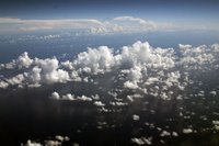
Across the thousands of miles of ocean, the view has been beautiful. The sea has been as calm as a sheet of glass for the past hour or so and the crystal white clouds rise like pillars between sea and sky of safire blue. We arrive in Guam this evening and then it is on to Saipan where I will meet the rest of the crew and find out what the next few days have in store.